AI computer vision, decision support and display

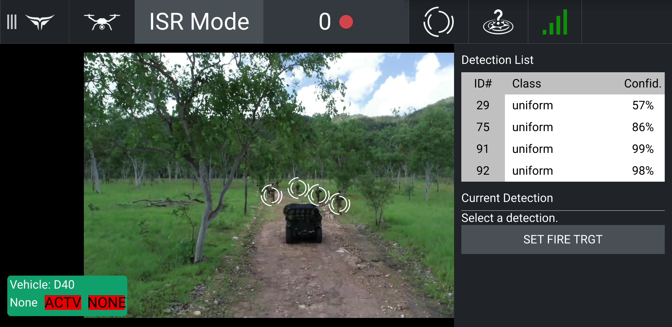
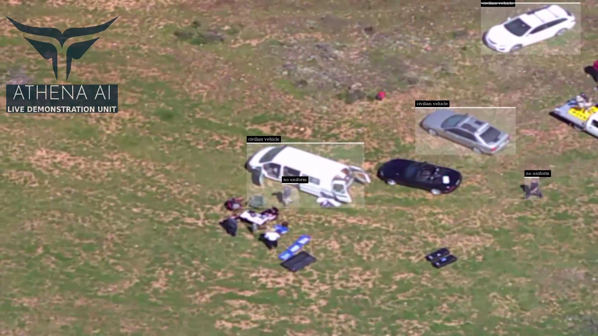
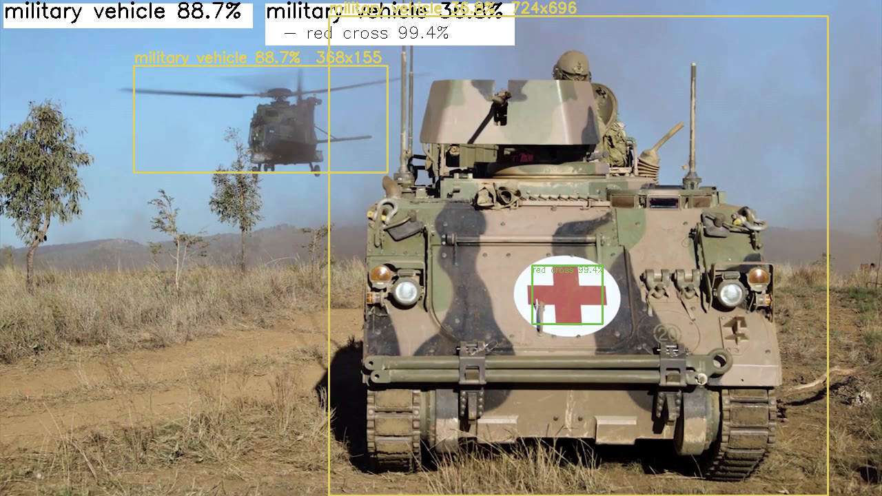
Our AI vision systems combine over 50 object classes across EO and IR for decision support and image exploitation. It includes the following features:


Battle tracking of identified objects with camera parameters

Multiple neural networks operating in parralel to optimise speed and accuracy

Large and small object classification

Rapid neural network updates for new object classes

Dynamic adjustment of thresholds for precision and recall

Geospatial

  • Our Geospatial toolset enables satellite and LIDAR analysis for:
  • Autonomous route planning based on key parameters
  • Line of sight assessments
  • Advanced blast and ballistic trajectory modelling
  • Communications assessments

Mission

Athena’s Mission user interface allows Athena to be preconfigured for various assessments and providing data into reports and returns such as:

  • REDFOR
  • BLUEFOR
  • Available Weapons
  • Protected Areas
  • Rules of Engagement and LOAC Considerations
  • Fire mission, Recon Mission, SITREP etc.

Mission is designed to integrate effectively with ATAK / CIVTAK and other battlespace management tools.